![]()
2008 Relief Map ofWeare, New Hampshire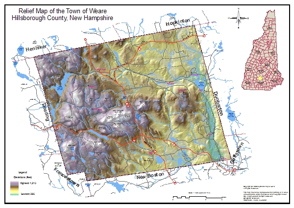
This full-color relief map of the Town of Weare, New Hampshire depicts the topographic relief of the land in the town, summit names (some with elevations), the long-abandoned Boston & Maine (B&MRR) Railroad bed location, lakes, ponds, rivers, streams, roadways (private and public) and numbered state highways. It was prepared by David Wayne Hurd. The scale of this map is 3/4"=1 mile. 26"x17" Full-color on premium bond paper - our price: $29.99 | |
|
| |